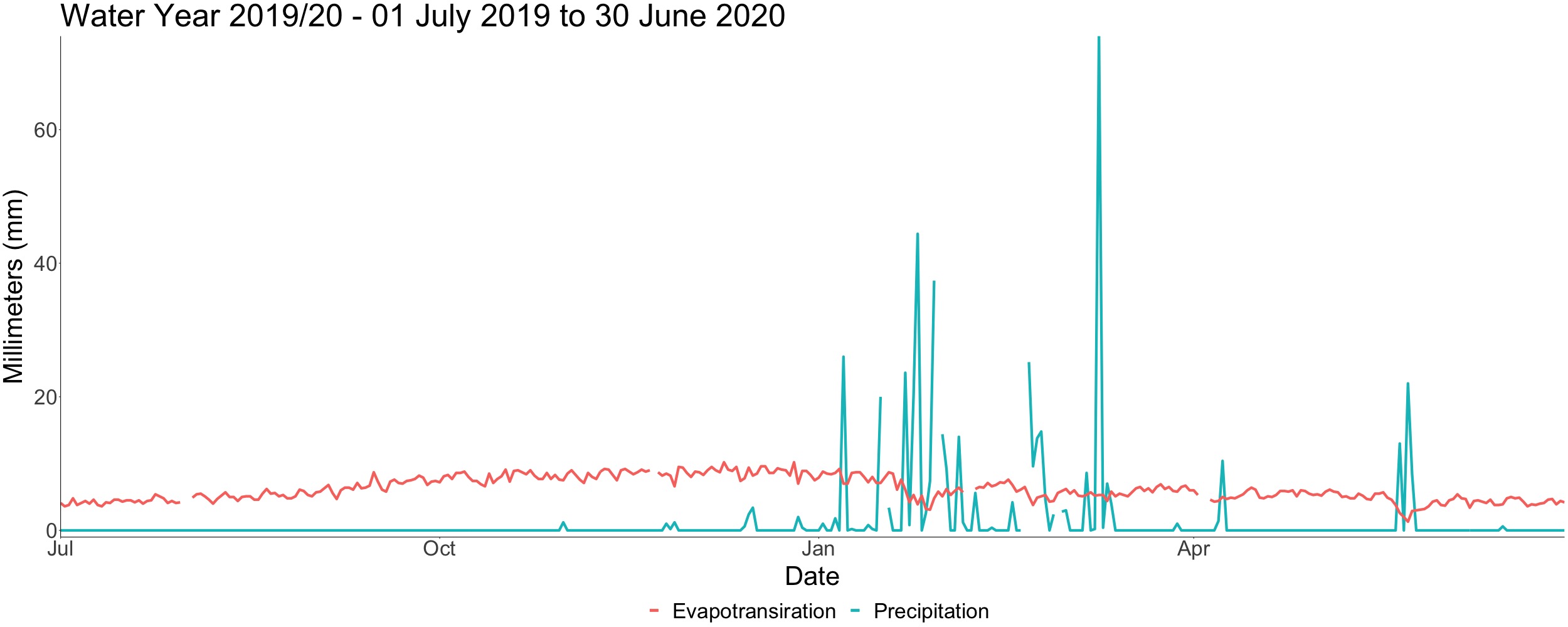
The climate of the Gilbert catchment region is semi-arid and comprised of distinct wet and dry seasons. With an average annual rainfall of 775 mm, 93% of this rain falls during the wet season (typically December to March). Evapotransiration represents a major loss of water from the system; on average evapotransiration is over 1800 mm per year.
Compared to many agricultural areas in southern Australia there is a lack of in-situ (i.e., on ground) climate data in the north, including the Georgetown region. However, rainfall is highly variable across the catchment and within properties. rom a property management perspective, one landholder spoken to as part of the QWMN Gilbert Digital Twin project felt there is no real need for spatial estimates of rainfall. In 2021 they had more that 500mm fall in a few days which resulted in huge runoff that could not be captured, impacted infrastructure and led to erosion. This inherent variability was just something that had to be worked with.
The combination of high rainfall variation between years (and across properties) and high evapotransiration losses highlight the need to for secure and reliable water storage options and strong drought contingency plans if irrigated agriculture was to expand in the region. Equally, there are risks and associated costs posed by intensive rainfall events for crops and infrastructure.