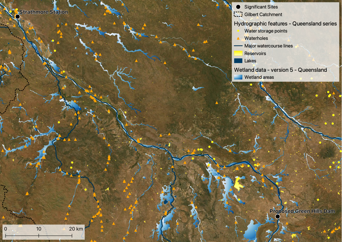
Surface water includes streams, rivers, lakes, wetlands, reservoirs, and creeks as well as surface runoff.
Water bodies, including farm dams, waterholes and wetlands, are important in the GRAP and throughout the Gilbert as they store water from the wet into the dry. This provides water for cattle as well as other flora and fauna who seek refugee in water bodies at the height of the dry season.
Watercourses (rivers, streams and creeks, etc) throughout the Gilbert catchment and the GRAP are fed by runoff from the land and in some places groundwater. As for the Water bodies of the region, the monsoonal climate means that many of the watercourses are ephemeral meaning they do not flow all the time. The major watercourse of the GRAP is the Gilbert River, from which water is currently available to support irrigated agriculture and other economic development opportunities.
Resources
On this website:
Data sources
Hydrographic features - Queensland series, accessed via Queensland Spatial Catalogue (QSpatial), includes data sets:
- Major watercourse lines
- Watercourse areas
- Lakes
- Reservoirs
- Water storage points Wetland data, accessed via Queensland Spatial Catalogue (QSpatial), includes data sets:
- Wetland areas