The several soil types occurring across the Gilbert catchment result from different underlying geology and weathering processes throughout the catchment.
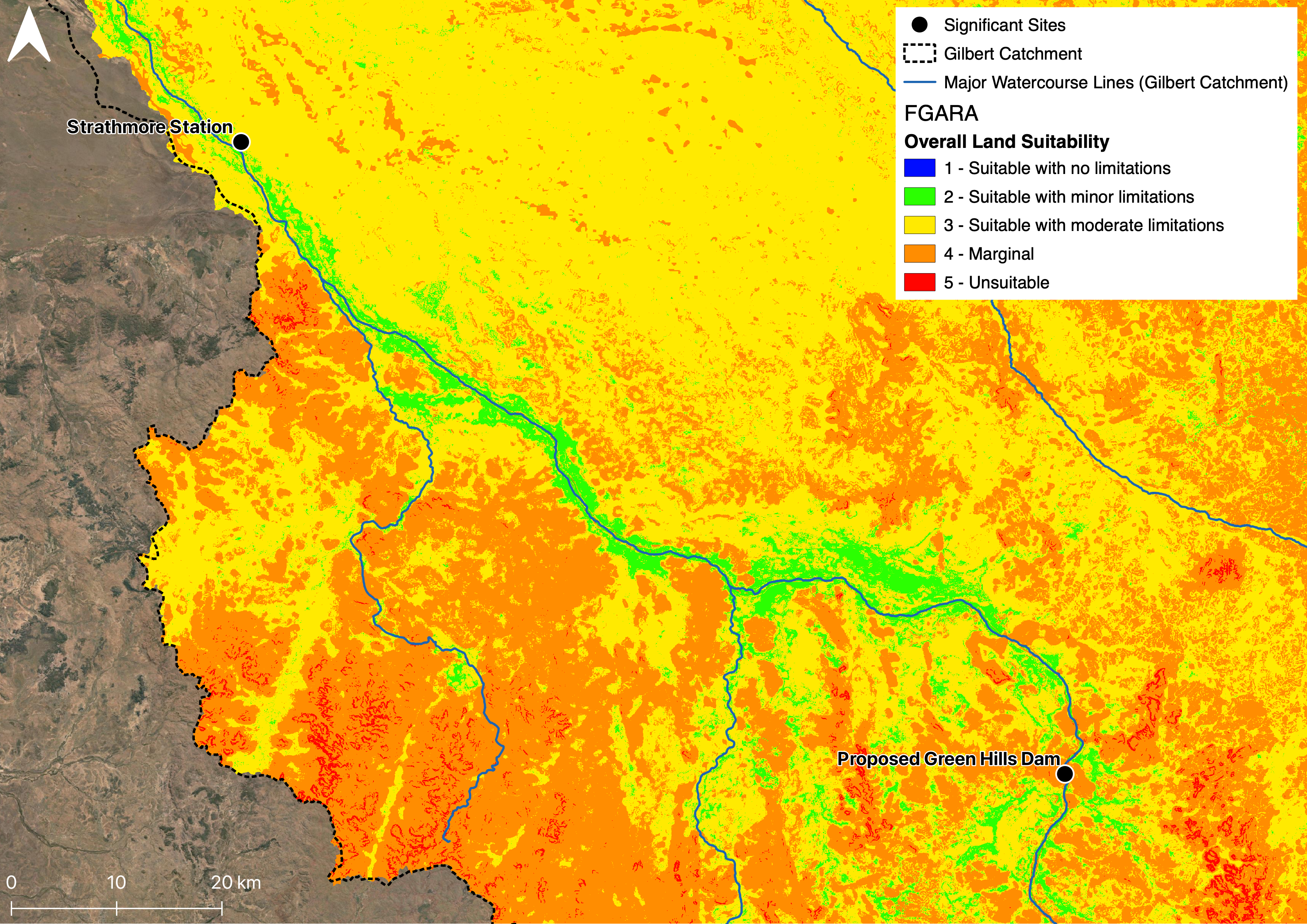
The presence of irrigable soils is not a constraining factor on the development of an irrigated agriculture industry in the Gilbert River catchment. The alluvial soils adjacent to the major rivers of the Gilbert catchment are most suitable for irrigated agriculture. This partially drove the identification of the Gilbert River Agricultural Precinct (GRAP) as the most promising region for the development of an irrigated agriculture industry in the catchment. These alluvial soils are deep (1.5 m +) and extend up to 2 km from the river. Researchers from both the Queensland Departent of Agriculture and Fisheries and the the University of Queensland have established dryland and irrigated cropping trials with collaborating landholders in the GRAP.
Individual crop land suitability maps were developed as part of CSIRO’s Flinders and Gilbert Agricultural Resource Assessment (FGARA), based on soil and climate data. The major crops types previously discussed as applicable to the GRAP (e.g., cotton, sugarcane, soybean, peanut, oats, navybean, mungbean, mango, lucerne, lablab, grape, chickpea, maize/corn, sorghum) were combined to understand overall land suitability of the area.
The sandy nature of much of the soil throughout the catchment was noted in CSIRO’s Flinders and Gilbert Agricultural Resource Assessment (FGARA) to have limited suitability for on-farm dams. However, specific areas on a farm may be well suited for on-farm water storage - landholders across the GRAP engaged with in the QWMN Gilbert Digital Twin project were able to identify potentially feasible sites based on the natural pooling of water.
Resources
- Agricultural resource assessment for the Gilbert catchment (Petheram et al., 2013)
- Soils and Agricultural Land Suitability of the Gilbert River Area; Chadshunt to Mt Sircom, Enderlin N.G. 2000
- An Assessment of Agricultural Potential of Soils in the Gulf Region, North Queensland; A report to Department of Natural Resources Regional Infrastructure Development (RID), North Region; 1:250k, Wilson and Philip, 1999
On this website:
Data sources
Public data sets from the CSIRO Flinders and Gilbert Agricultural Resource Assessment (FGARA) including soil related data sets:
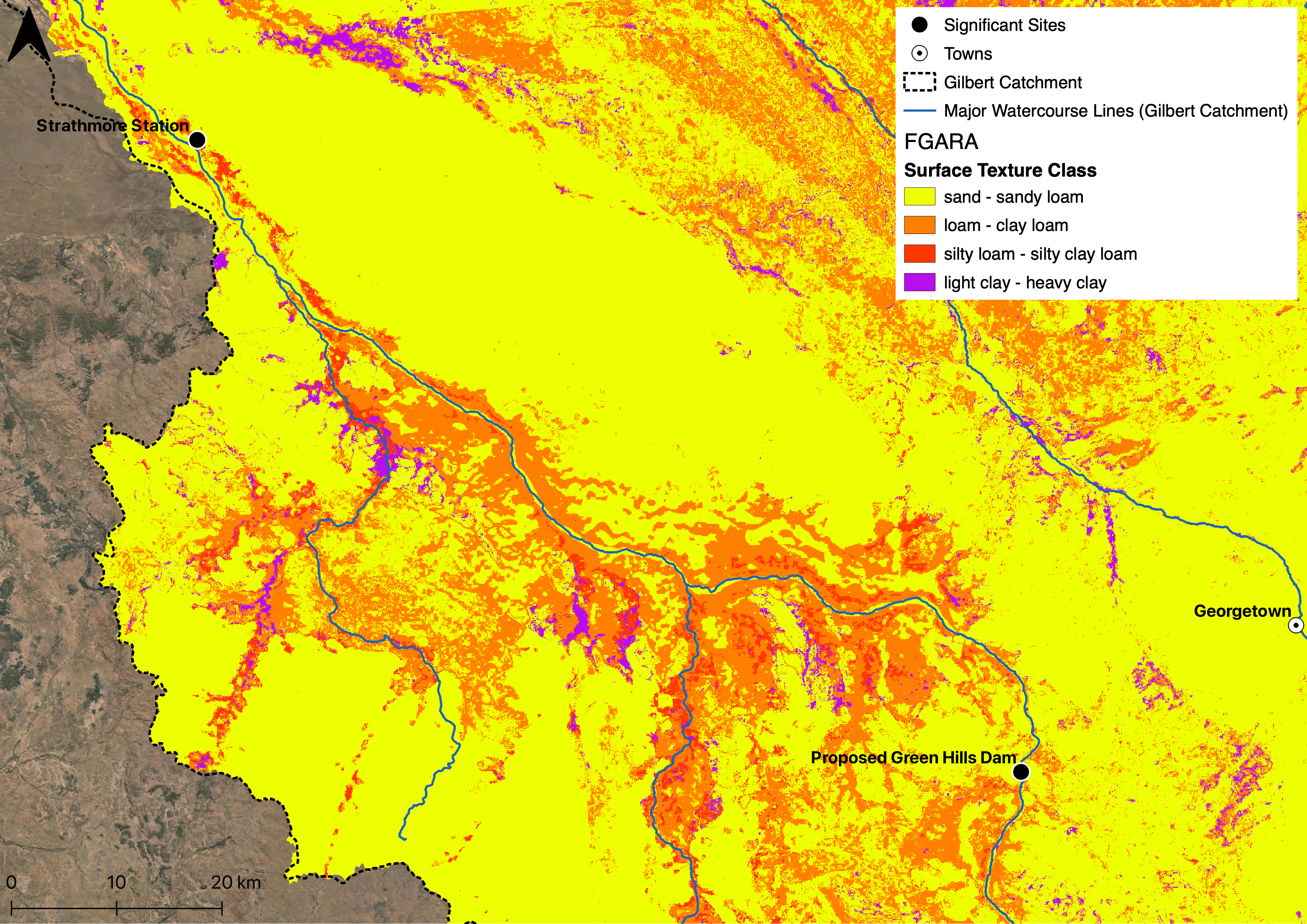
- Soil Surface Texture Class: sand/loam/clay
- Soil Surface Structure
- Soil Surface pH
- Soil Surface Condition
- Soil Surface Clay Percent
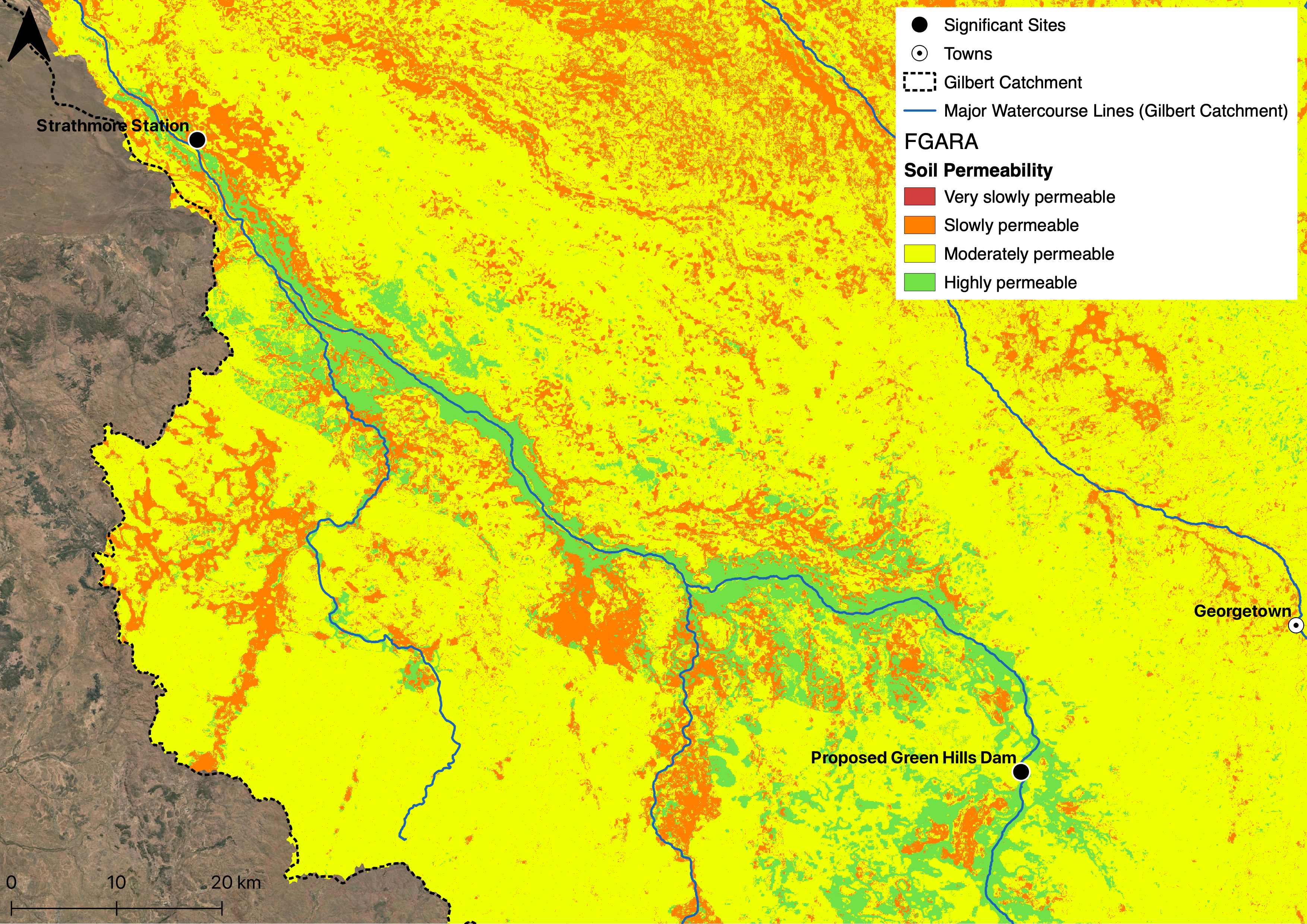
- Soil Permeability
- Soil Generic Group
- Soil Erosivity
- Soil Drainage
- Soil Depth
- Exchangeable Sodium Percentage (ESP) of Soil Surface
- Electrical Conductivity of Soil Surface
- Land suitability for multiple crops
Soil and Landscape Grid of Australia including data sets:
- Clay %
- Sand %
- Depth of Regolith
- Depth of Soil